Meteor Data Centre and Defra DTC
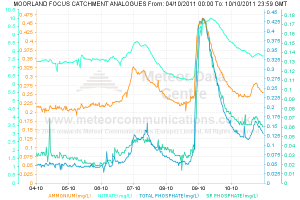
The EdenDTC team have been working with the Meteor Data Centre to store monitoring results and create graphical visualisations of the data.
Meteor Communications (Europe) Limited are proud to be supporting the consortia in the DEFRA Demonstration Test Catchment (DTC) project, bringing real time graphical data to the Eden DTC web site via embedded links to the Meteor Data Centre (MDC).
For an example of embedded real time data flows, please visit the this link. For more information about the Meteor Data Centre and the other types of data visualisation tools available, please visit the this link.

History of the Meteor Data Centre
In parallel with its environmental monitoring and other telemetry technologies, Meteor Communication’s end user computer applications have been developed over 25 years for high profile, mission critical real-time monitoring, including the river Thames and its tributaries, currently the most intensively monitored catchment in Europe.
Design Philosophy
The Meteor Data Centre is designed and built around a set of core principles:
| Secure | Robust and resilient to attack. |
| Intuitive | Easy to use end user interface, no special training required. |
| Powerful | Highly functional end user interfaces and applications, developed and refined with industry experts over many years. |
| Flexible | High level of user configuration and the facility for product branding. |
| Flexible | Future proof system architecture for extended system life cycles. No dependence upon a supplier’s design paradigm. |
| Open | Standards based platform for applications and data exchange: W3C, OGC, XML. |
| Available | High level of availability across multiple end user browsers and devices |
Through its use of advanced software engineering tools and methods, Meteor continues to remain at the cutting edge of application development. Multiple user agents are supported including all major web browser types (IE, Firefox, Safari, etc.), smart phones (Blackberry, iPhone, etc.), tablets (iPad, etc.) and geospatial viewers (Google Earth and Maps). Contextual information such as mimic diagrams, photographs, and live video is also supported.
Data and graphs can be accessed externally via downloads, XML formats or as RESTFul URLs.